TESAnnwyn: Output Examples
This page contains some example screenshots of what TESAnnwyn can do.
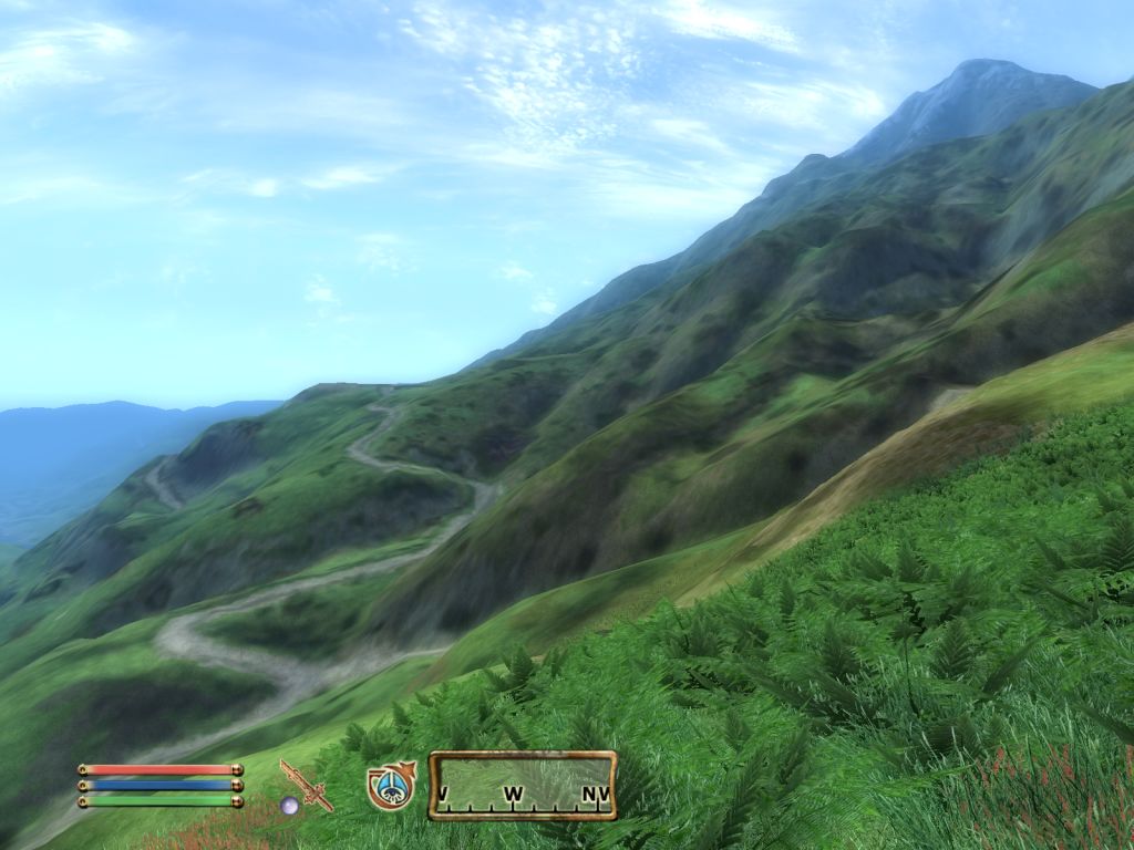
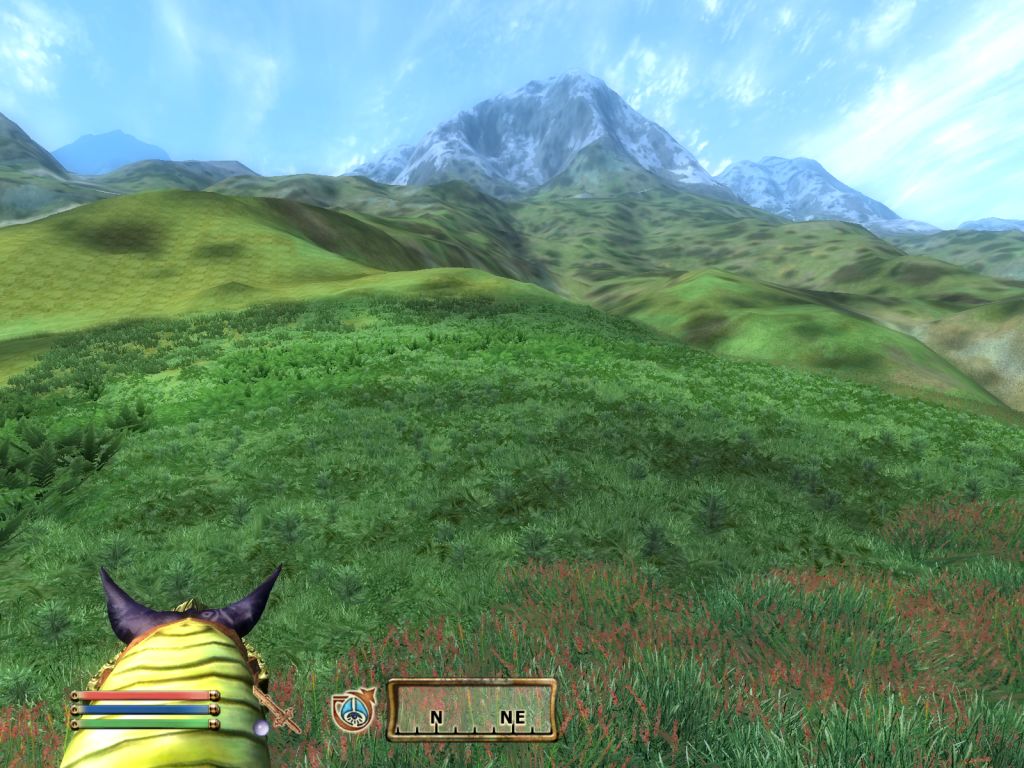
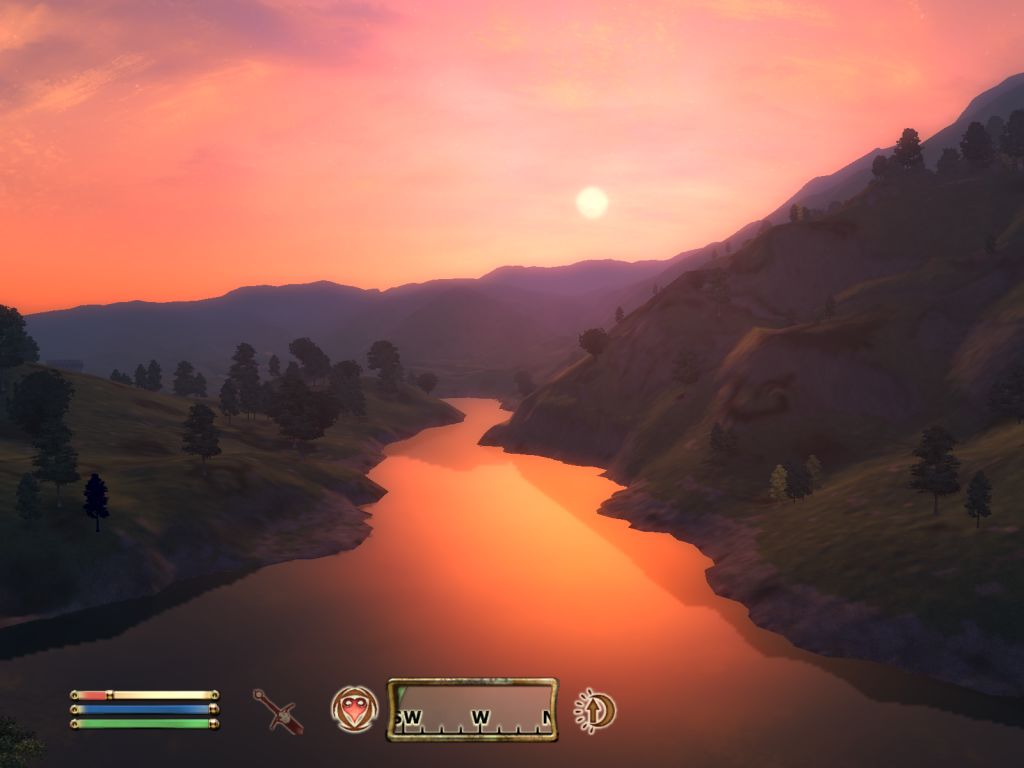
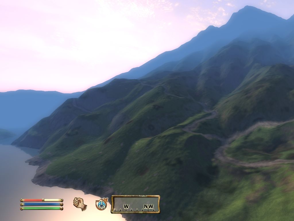
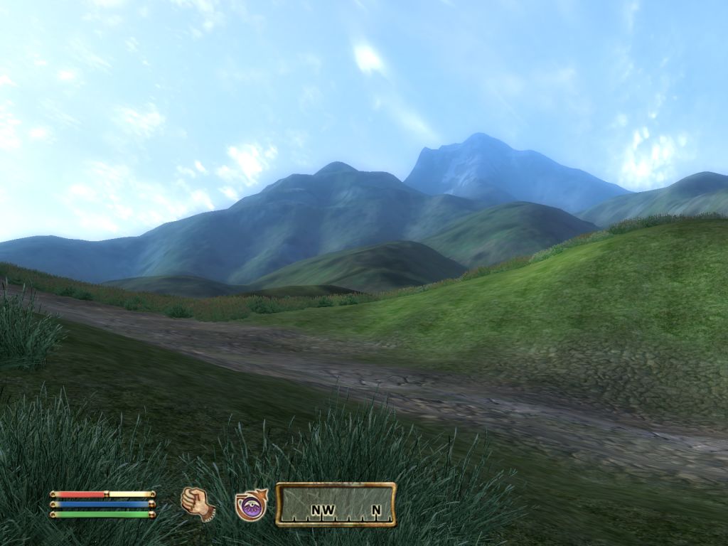
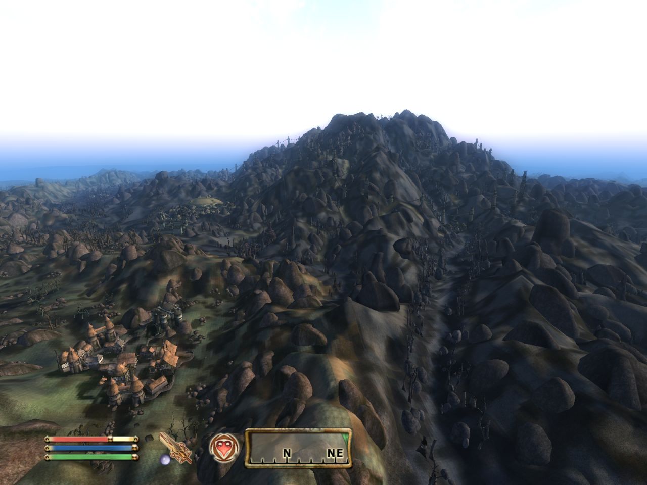
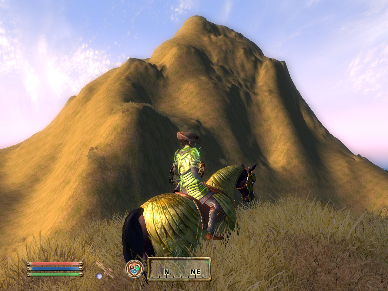
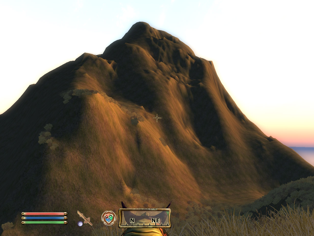
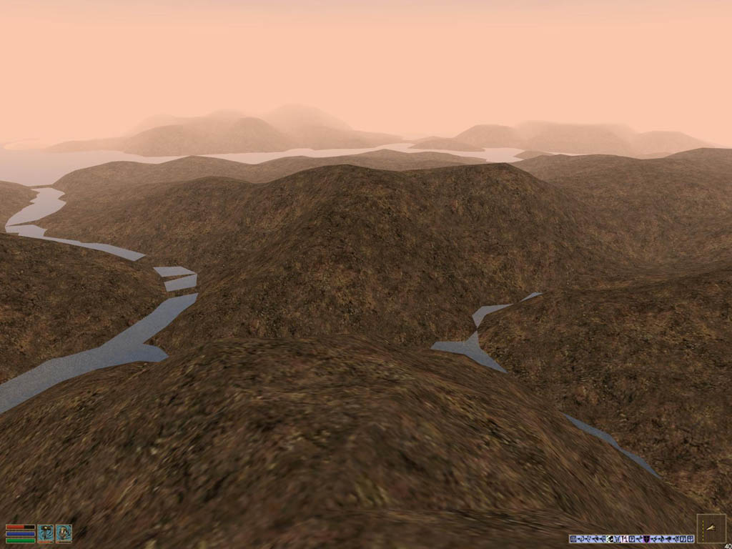
1. Scaling the TES4:Oblivion game to 2x and 3x scale
TESAnnwyn can import/export the texture placement layers as well as the vertex colour map, so all detail is preserved when scaling a landscape for either game engine.
At 2x scale the land area is increased from the original approx 25 square miles to over 100 square miles (click any picture to see more shots of the world at this 2x scale):
And 3x scale, 250 square miles. Click any picture to see more shots of the world at this 3x scale:
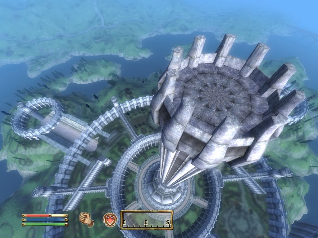
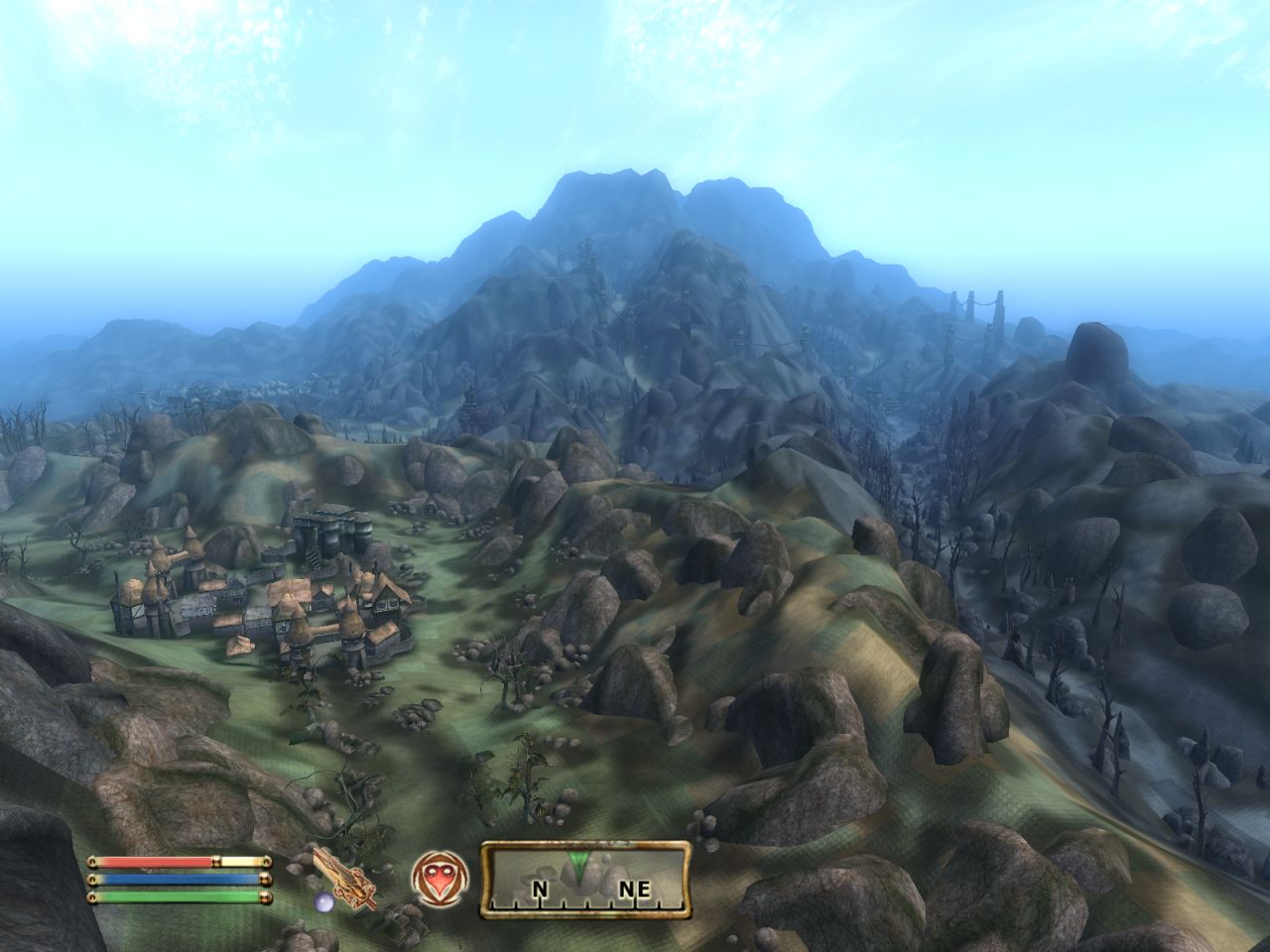
2. Scaling TES3:Morrowind and importing to TES4:Oblivion at 2x scale.
TESAnnwyn can also do TES3->TES4 texture replacement mapping, so any world pulled from the old game will use Oblivion's much higher res textures, including 3D grasses.
Clicking any of the pictures will take you to a page full of 2x scale screenshots, including early, failed scaling techniques.
|
|
Dagoth Ur at 1x Scale
|
Dagoth Ur at 2x scale
|
TESAnnwyn also re-calculates the normals, so the shading is correct throughout the day.
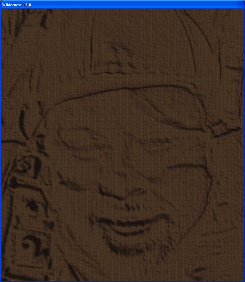
3. Embossing/Engraving: Turn a photo in to a 3D landscape.
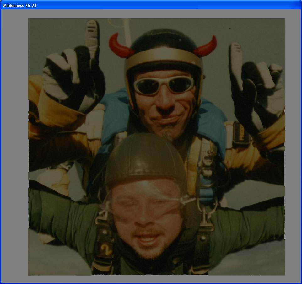
By taking the following picture (of me tandem skydiving from 15,000 feet over Lake Taupo, New Zealand in 2004):

Turning it in to an 8-bit Greyscale in Photoshop and loading it in to TESAnnwyn:
TESAnnwyn skydive1.bmp
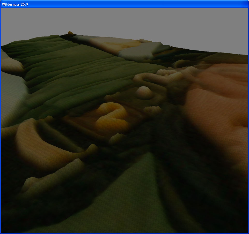
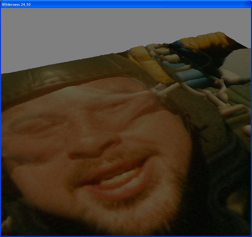
This is what portions of the resulting 3D landscape looks like in the CS when imported as an 8-bit greyscale.
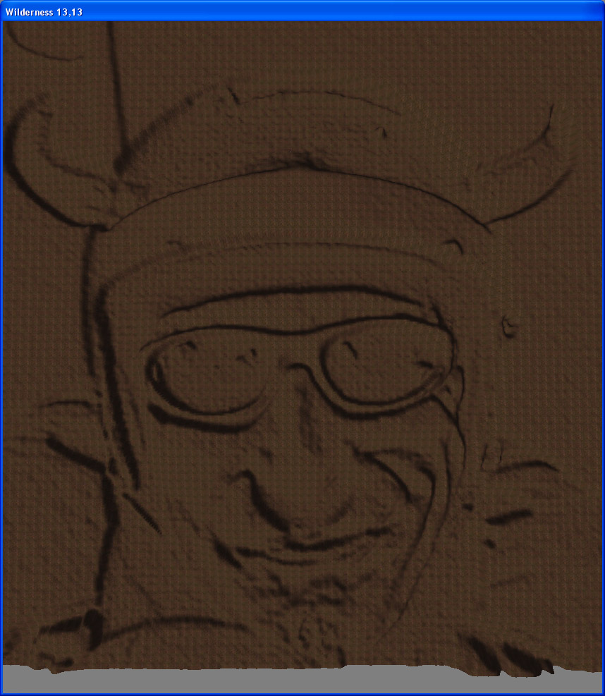
The instructors wind rippled face is on the left, a crazy German Skyboarding Champion with a horned helmet, called Freddy.
My face is on the right, trying to look calm and composed. You can see the number 2 on my shoulder and the faint bristles of my goatie.
This process is completely reversible. You can import a high detail greyscale photograph in to a landscape, export it again and the
resulting image is identical to the original photograph.
When we import the colour version as the Vertex colour map with the greyscale heightmap, this is what we get:
Yeah, those really are screenshots from the TES4 CS. Pretty cool eh? ;)
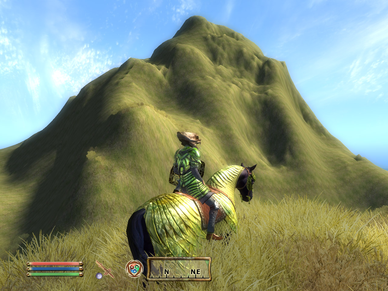
In game, the scale is huge:
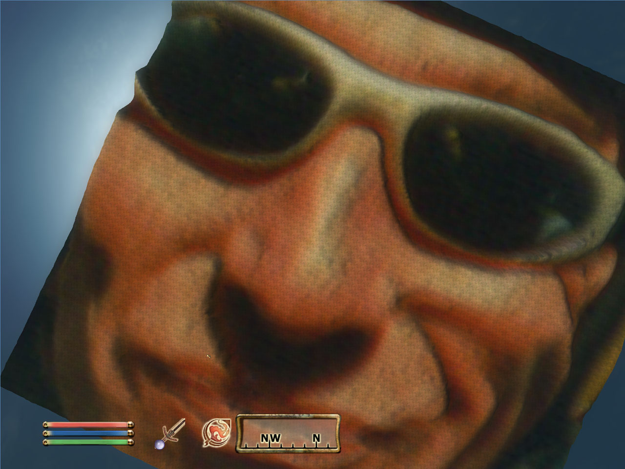
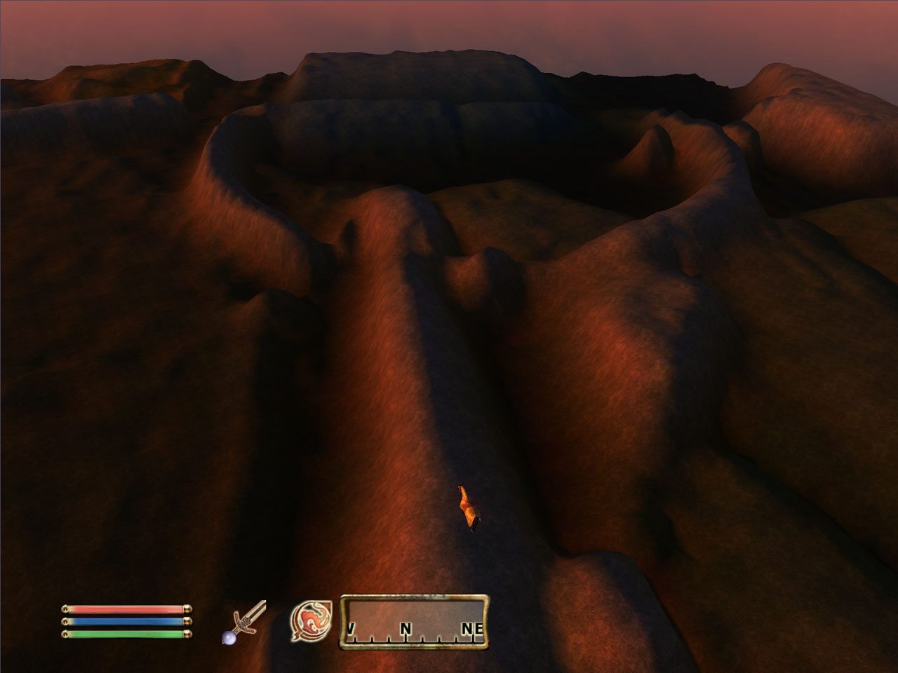
My horse is that bright spec just below Freddy's right nostril. We have to hover about 250m high in the air to get this perspective.
The image on the right is the parachute buckle on my left shoulder, seen in twilight.
4. Embossing/Engraving Example II.
Embossing or engraving an image on to a landscape is trivial, though it is best seen from a distance. It's even more impressive when imported with a vertex colour map. It's an interesting
feature, mostly useless from ground level, but could be used to produce some startling effects from a mountain-top.
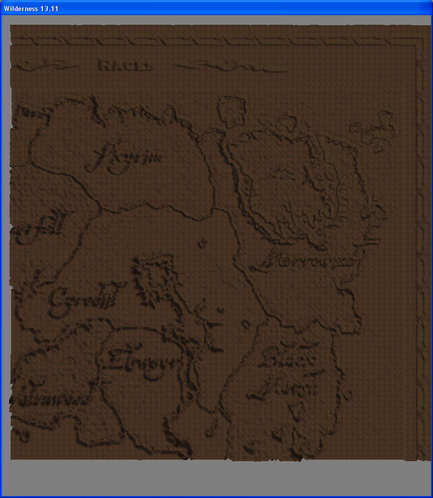
I took a screenshot of the Elder Scrolls map page from the official
website, turned it in to an 8-bit Greyscale and ran it through TESAnnwyn:
TESAnnwyn screenshot.bmp
In the CS you can see the map emblazened on the land surface (several hundred square metres!). If one were to add texture and lighting,
the effect could be much more interesting.
Importing the greyscale heightmap with an idential 24-bit colour version as the vertex colour map is especially neat. If you take a screenshot, save one copy as a 24-bit colour BMP called
tesannwyn-vclr.bmp and another copy as an 8-bit greyscale called, say, screenshot.bmp and type this:
tesannwyn -i 4 -s 0.5 -c screenshot.bmp
This how it looks in the TES4 Construction Set:
|
|
| To the right of the map, this advert appears on the Elder-Scrolls website
|
This is the map turned in to a 3D landscape.
|
|
The -i 4 option tells TESAnnwyn to produce a TES4 (Oblivion) ESP. The -s 0.5 is optional, but halves the value of
all height points, which prevents 8-bit gradient overflows occuring between black and white contrasting images.
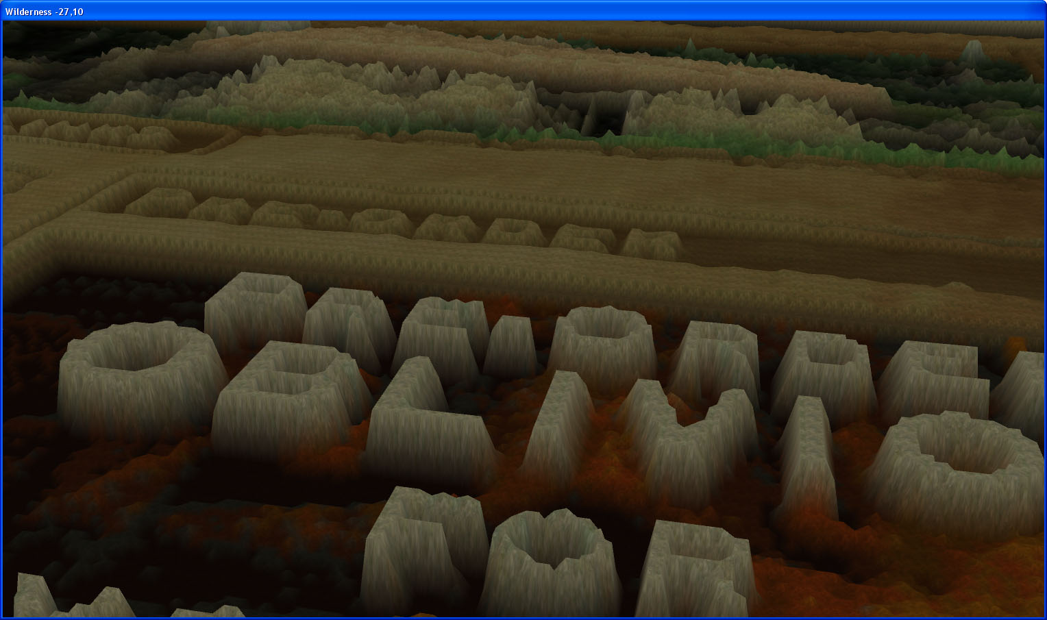
The scale is of very large however, which limits its novelty somewhat. For example this is a portion of my web-page with an Imperial Palace White Tower placed alongside it and another
web-browser screenshot from the Silgrad Tower website with a Cathedral placed on it.
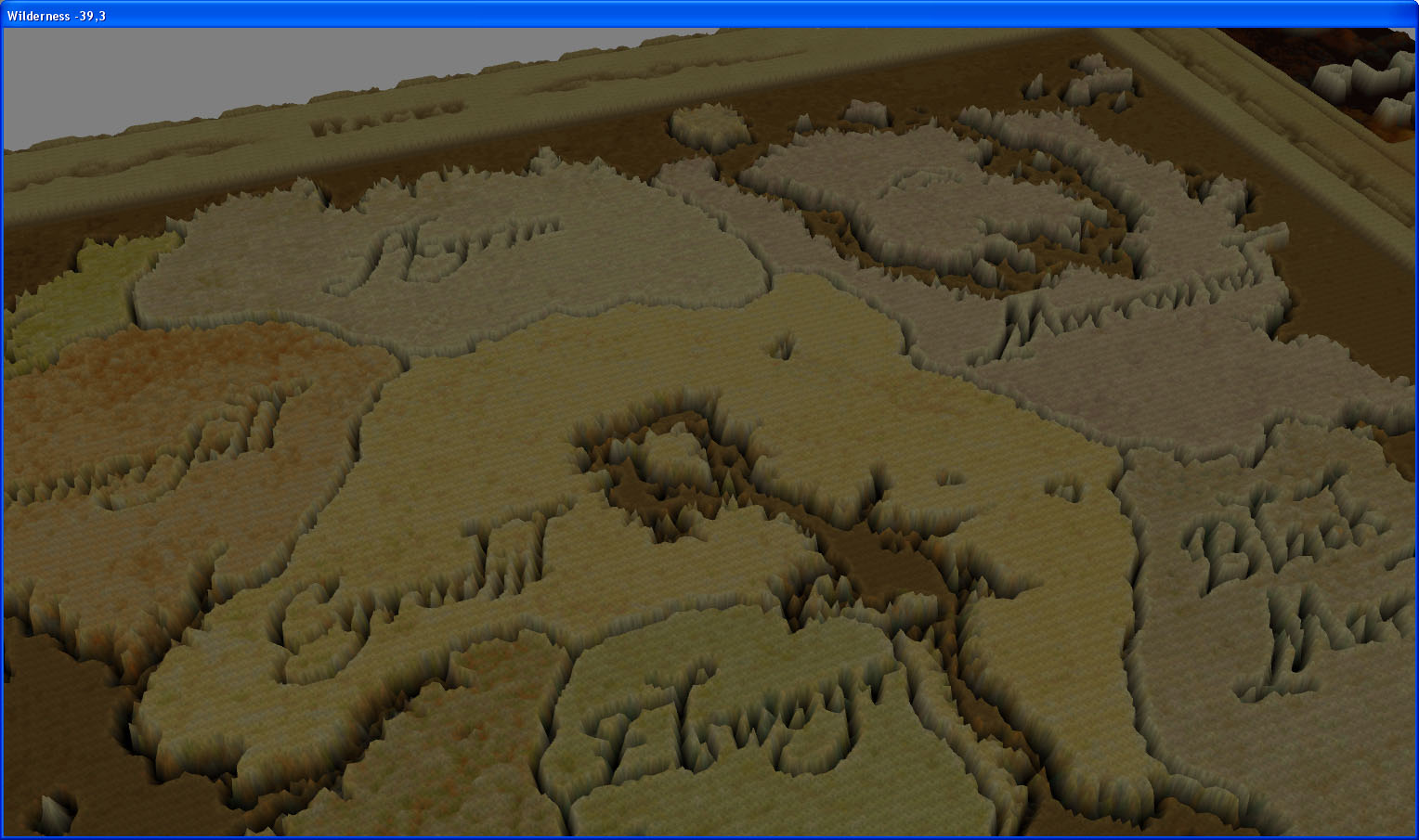
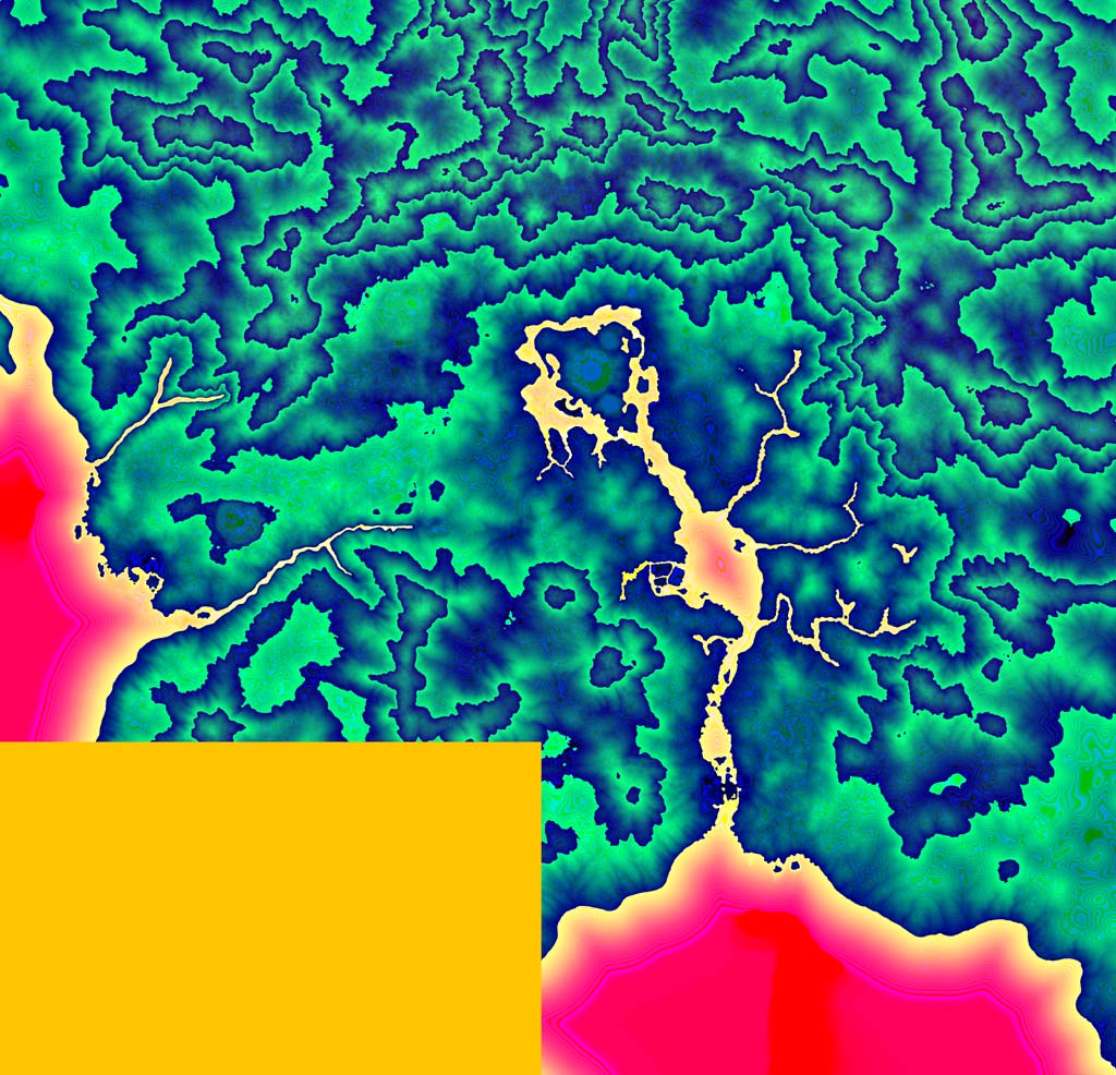
5. A Scaling Example: Creating a 1/16th scaled miniature of Oblivion's Tamriel Worldspace landscape.
This procedure is described in the readme. To generate an overview of the landscape, you may run:
TESAnnwyn -p 2 -b 16 -w Tamriel Oblivion.esm
Which will create a high detail BMP (much more detailed version of the web friendly jpeg below), useful for visualization, though not so useful for
heightmapping purposes since most image programs try to process the RGB components individually, rather than 16 or 32-bit integers.
NB. The yellow block to the bottom is empty land; Bethesda have not put any landscape in this area in the original game.
|
|
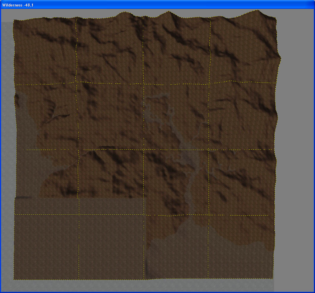
A 16-bit BMP heightmap. |
Untextured, as seen in the TES3 Construction Set - cell borders are yellow.
|
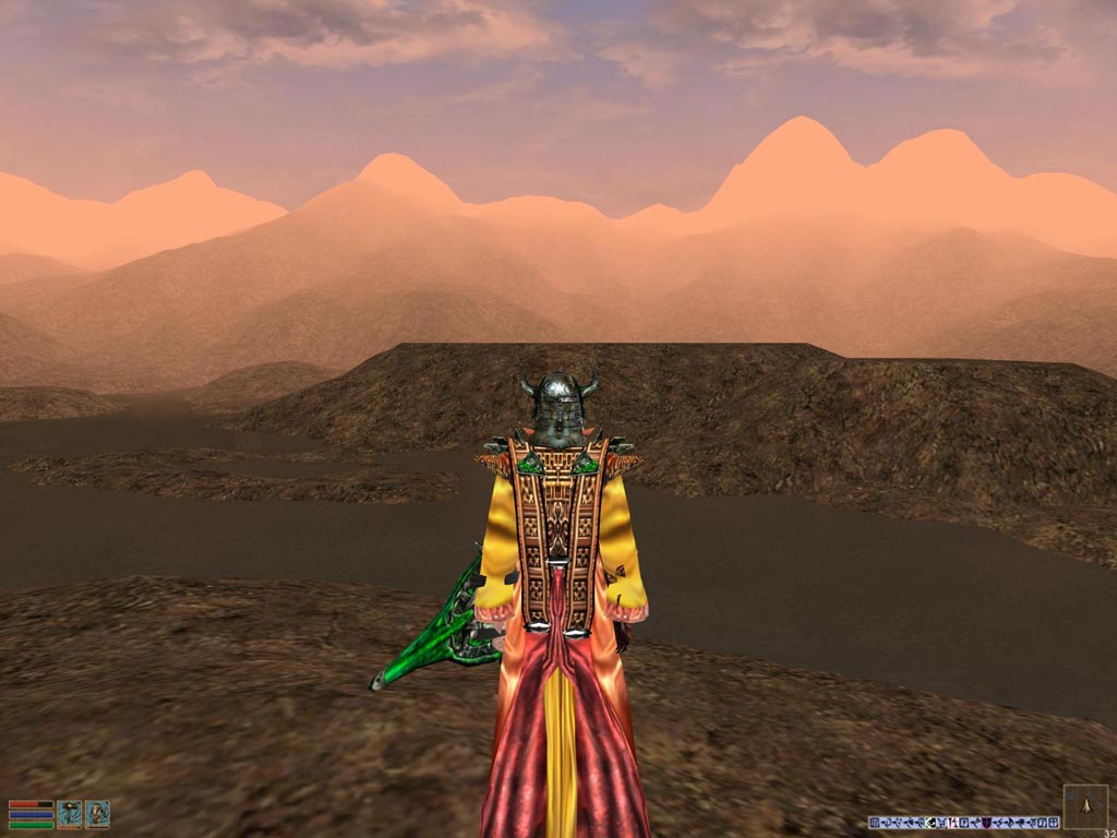
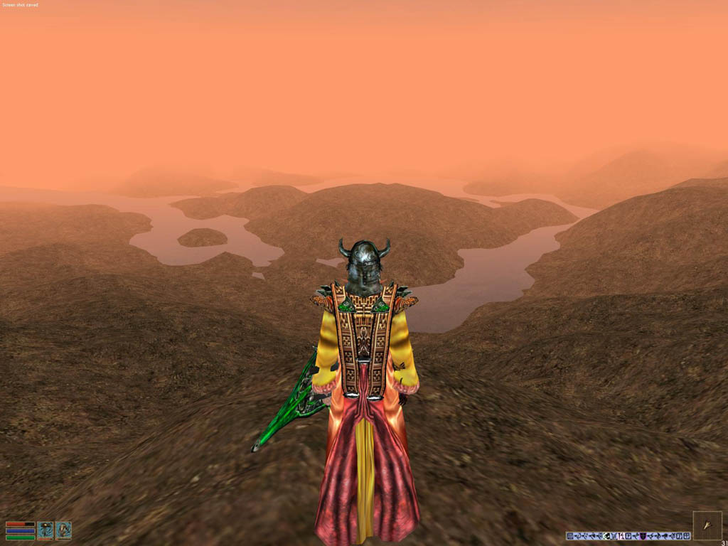
Here are 3 shots in-game (in the TES3: Morrowind game engine) standing near the Imperial City island. The first shows the arc of
the Imperial Dockland to the left. Scaling down always loses detail (a morrowind cell can only contain 64x64 data points),
but the effect is fine. You can quickly travel to and get a good impression of all those places you couldn't travel
to in the original game (60% of the landscape is normally unreachable in the official Oblivion game).
You may download the resulting TES3 ESP and a Readme from this link: TESAnnwyn-Cyrodiil16th.rar
Lightwave. 14-Jan-2007.